
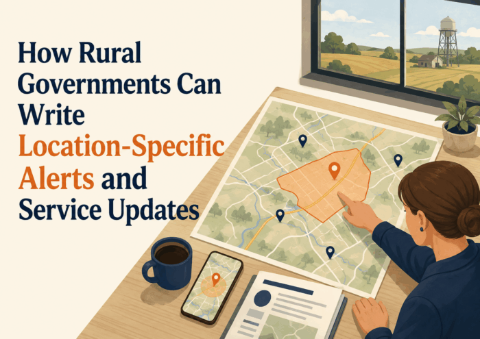
How Rural Governments Can Write Location-Specific Alerts and Service Updates
Geographic precision is among the most fundamental requirements of effective rural government communication, and it is among the most frequently neglected. A county road closure that affects three miles of a specific township road tells a resident who lives four miles away nothing useful and tells a resident who lives a quarter mile from the closure everything. A boil water advisory that describes the affected area as the eastern portion of the service area may encompass hundreds of households or dozens, depending on how the service area is shaped and where its eastern boundary falls. A road weight restriction notice that applies only to certain routes within a township may be irrelevant to most residents and critically important to the agricultural operations that use those specific roads.
The problem is not that rural governments lack the knowledge of their geography that specific notices require. Public works employees know exactly which roads are affected by a weight restriction. Utility system operators know exactly which portions of the distribution system are downstream of a main break. Emergency management staff know exactly which neighborhoods are in the path of a flood warning. The problem is that what these staff members know intuitively does not automatically translate into the kind of specific, resident-accessible geographic description that residents need to determine whether a notice applies to them.
This article addresses how rural local governments can write location-specific alerts and service updates that allow residents to quickly determine whether they are affected. It covers how to describe rural locations using the landmarks and references that rural residents actually use for orientation, how to supplement text descriptions with maps and visual aids, how to handle notices that apply to specific service areas or jurisdictional boundaries rather than to recognizable geographic features, how to write different versions of a notice for different affected populations within the same service area, and how to use technology to improve geographic specificity without requiring significant technical investment.
The principles apply to any local government communication where geographic specificity matters, including road closure notices, utility disruption alerts, service change announcements, emergency warnings, and any other communication where the first question a resident will ask is whether this applies to me. Getting that question answered clearly and immediately is the primary purpose of location-specific communication, and achieving it consistently requires both the right content and the right approach to describing rural geography in terms residents recognize.
The Cost of Geographic Vagueness
 When a service notice, emergency alert, or informational update is geographically vague, the costs are distributed across multiple parties in ways that compound and interact. Residents who cannot determine from the notice whether they are affected must call the office to ask, which consumes staff time answering calls that a better notice would have prevented. Residents who assume they are not affected when they are may fail to take necessary precautions, comply with restrictions, or prepare appropriately for service changes. Residents who assume they are affected when they are not may take unnecessary steps that cost them time and money.
For emergency communication, the cost of geographic vagueness can be measured in public safety terms. A boil water advisory that does not clearly describe the affected households may result in some affected residents continuing to use tap water because they were not certain the advisory applied to them. A road closure that does not describe the exact segment affected may result in a driver encountering the closure unexpectedly at a point where the alternative route requires significant backtracking. A flood warning that describes the potentially affected area in general terms may leave some at-risk residents uncertain whether to evacuate.
For routine service communication, the cost of geographic vagueness is measured in resident frustration and staff burden. An agency that issues a road construction notice that generates two dozen phone calls asking exactly where the construction is occurring has not saved time by omitting the specific location. It has shifted the time burden from notice preparation to phone responses, while creating a more frustrating experience for residents than a complete notice would have produced. Geographic vagueness also compounds over time by eroding community trust in official communication. Residents who have learned that the agency’s notices are rarely specific enough to answer their basic questions will stop reading them carefully and start calling instead, or ignoring notices altogether.
Engaged & Connected: Communication Strategies for Small Towns, Villages, Townships, and Rural Communities
This article is part of our series on strategic communication for Small Towns, Villages, Townships, and Rural Local Governments. To learn more and to see the parent article, which links to other content just like this, click the button below.
Using the Language of Rural Geography
Rural communities have their own geographic vocabulary that is often more precise and more widely understood locally than official road names, parcel numbers, or municipal boundaries. The crossroads that locals call by the names of the two roads that meet there. The creek that gives a neighborhood its informal name. The grain elevator or the feed store that serves as the landmark everyone uses for orientation. The old bridge whose name has transferred to the current crossing. The farm with a distinctive feature that everyone in the area knows. These informal geographic references are often more communicative for rural residents than official addresses or GPS coordinates.
Effective location-specific communication for rural audiences uses this local geographic vocabulary alongside official designations. A road closure notice that says the closure affects Township Road 14 between the intersection of County Road B and the railroad crossing at the grain elevator is more immediately useful to residents than one that cites only a range of addresses. The former uses landmarks that residents recognize from daily experience. The latter requires residents to translate addresses into locations, which many cannot do quickly or confidently.
Learning the local geographic vocabulary requires the same familiarity with the community that good rural government communication requires in general: regular contact with residents, awareness of the informal names and references they use, and willingness to use that vocabulary in official communication rather than defaulting to the more formal language of road management systems and databases. Staff members who work in the field every day typically know this vocabulary. The challenge is ensuring that it makes its way into notices and alerts rather than being replaced with formal language during drafting and review.
Landmark references should be current and accurate. A landmark that no longer exists is not a useful reference point even if it was once universally recognized. Notices that use outdated landmarks may confuse newer residents and those who have moved away but still own property in the area. When in doubt about whether a landmark reference is current, supplementing it with cross-street references or address ranges ensures the notice remains useful regardless of whether the landmark is still widely recognized.
Describing Service Areas and Jurisdictional Boundaries
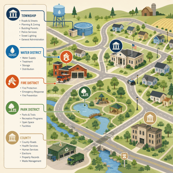
One of the most challenging location-specific communication tasks for rural local governments is describing service areas and jurisdictional boundaries in ways that residents can use to determine whether they are within the relevant area. A water district service boundary, a fire protection district boundary, a township road maintenance boundary, or a zoning district boundary may have a precise legal description that is meaningless to most residents trying to determine whether they need to act on a notice.
Maps are the most effective tool for communicating service area and jurisdictional boundaries. A map on the agency’s website that clearly shows the service area boundary, labeled with the names of surrounding communities or roads that residents recognize, allows a resident to self-locate and determine whether their property is inside or outside the boundary. For notices that apply only to part of a service area, a map showing the relevant portion with a clear visual distinction from the rest of the area communicates the scope far more effectively than any text description.
When a map is not practical for a specific notice format, the boundary description should use the most recognizable references available: roads, waterways, compass directions from named intersections, and named communities rather than legal parcel descriptions. A service area boundary described as encompassing all properties east of State Route 22, north of Township Road 8, and within the township limits is more accessible than one described in legal survey language, even if both are technically precise.
Writing Multiple Versions for Different Affected Areas
Not every notice requires the same content for all residents. A major road construction project may affect some residents with a full closure, others with a partial restriction, and others only with increased traffic on a detour route. A utility system repair may affect some customers with a complete service interruption and others only with reduced pressure or temporary discoloration. When a single notice would have to describe significantly different situations for different affected populations, writing separate versions for each group produces better communication than trying to cover all situations in one notice.
Separate versions allow the agency to lead each notice with the specific information most relevant to that group’s situation. A resident who lives along the closed road gets a notice that begins with the closure and the access plan for their driveway. A resident who lives two streets over gets a notice that begins with the detour and the expected duration of increased traffic. Both residents receive complete and accurate information, organized around their specific situation rather than around the agency’s operational perspective.
The decision to write multiple versions should be based on whether the differences in impact are substantial enough that a single notice cannot address all groups’ needs without significant confusion or omission. If the impact is essentially the same for all affected residents and the geographic scope can be described clearly in a single notice, a single version is appropriate. The additional drafting effort of multiple versions is justified when the impact differences are meaningful and when a single notice would require residents to read through information that does not apply to them to reach what does.
Maps and Visual Aids as Essential Communication Tools
Maps are not optional enhancements to location-specific communication. For many types of rural government notices, a map is the primary communication vehicle and the text is the supporting explanation. A road closure map that shows the closed segment, the detour route, and the key landmarks along both is more useful to a rural resident planning their route than any text description, regardless of how carefully that text is written. A utility service area map showing which addresses are affected by an advisory is more useful than any text boundary description.
Creating maps for every notice does not require a GIS department or specialized software. Many rural local governments have access to county parcel maps, road network maps, and service area boundary files that can be annotated with basic drawing tools to create usable notice maps. Free online mapping platforms allow staff to create and export maps quickly without specialized technical skills. The key is having the underlying geographic information available and staff with basic familiarity with the tools to annotate and export maps when needed.
Maps distributed with notices should be designed for readability at the scale they will be seen. A map that is clear and legible on a desktop monitor may be too small to read on a smartphone and too large to print legibly on a standard sheet of paper. For agencies that regularly produce location-specific notices for similar types of situations, developing a set of base maps for the most commonly affected areas significantly reduces the time required to produce maps for specific notices. A base map of the township road network can be annotated quickly to show a specific closure without requiring the map to be created from scratch each time.
Using Technology to Improve Geographic Specificity
Technology can significantly improve the geographic specificity of rural government communication without requiring large investments or specialized expertise. Online mapping platforms that allow the public to view a map and enter an address to determine whether they are within an affected area are among the most resident-friendly geographic communication tools available. A utility agency that posts an interactive map of a current service disruption, allowing customers to zoom to their address and confirm whether they are within the affected area, provides far more precise information than any text description.
GPS coordinates attached to emergency notices allow residents who use navigation applications to go directly to the precise location of an incident or closure rather than navigating from a text description. Digital alert systems that allow agencies to target notifications to specific geographic zones send alerts only to residents who are actually within the affected area rather than distributing general alerts to the entire service area. A utility disruption affecting a specific neighborhood does not need to generate alerts for residents in other parts of the service area who are not affected. Targeted geographic notification reduces alert fatigue and makes each alert more significant because recipients know it was sent specifically to them.
Building Geographic Specificity Into Communication Workflows
The most reliable way to ensure that location-specific communication is consistently specific is to build geographic detail requirements into the templates and checklists that govern how notices are produced. A road closure template that has a dedicated field for the specific road segment, defined by cross streets and landmarks, will produce more specific notices than one that simply has a field for road name. A utility disruption template that requires the affected area to be described in multiple ways, including by road names, landmark references, and a map attachment, will produce more useful notices than one that leaves the geographic description to the discretion of the person preparing the notice.
Training staff on how to describe rural geography in terms residents understand is as important as providing templates. A staff member who is expert in the field but who has never thought about how to translate field knowledge into resident-accessible language may default to internal reference systems, road numbers, or technical terminology that is accurate but not accessible. Review processes for notices should include a geographic specificity check: can a resident unfamiliar with the agency’s internal systems determine from this notice whether they are affected? That question, asked during review rather than after publication, catches geographic vagueness before it reaches residents.
Emergency Communication and Geographic Precision
Emergency communication has the highest stakes for geographic precision because the consequences of uncertainty about whether a resident is in an affected area can range from unnecessary fear to genuine public safety risk. Emergency communication for rural communities should identify the affected area through multiple overlapping descriptions rather than relying on any single description to be universally understood. A combination of road names, landmark references, compass directions from named intersections, distance references, and if possible a visual map gives every resident multiple pathways to self-identify as affected or unaffected.
For geographically complex emergency situations, such as flooding that follows a specific creek corridor with multiple tributaries, or a contamination situation that may affect different areas at different times, the geographic description should be updated as the situation evolves. The initial notice should describe the known affected area and commit to updates as the situation changes. Each update should include a revised geographic description that clearly indicates how the affected area has changed since the previous notice.
Seasonal and New Resident Geographic Communication
Rural communities typically include populations whose geographic familiarity varies significantly. Long-term residents know the local landmarks and informal place names that experienced community members use for orientation. Newer residents who have recently moved to the area, and seasonal residents who spend part of the year in the community, may have gaps in their local geographic knowledge. Both groups need communication that bridges between official geographic references and the informal local vocabulary without relying exclusively on either.
New resident communication for location-specific notices works best when it combines official road names and geographic designations with local landmark references. A new resident who knows the official road names from a map but does not yet know local landmarks can orient themselves from the official designations. A long-term resident who navigates primarily by landmarks and does not track official road numbers can orient themselves from those references. Combining both types of references in the same notice serves both audiences and costs nothing additional in the notice-drafting process.
Seasonal residents may own property within the affected area but receive mail at a primary residence elsewhere. For significant location-specific notices affecting property access, utility service, or emergency situations, mailing to the property address ensures the owner receives the notice regardless of their current location. Agencies that maintain email contact for seasonal property owners can supplement direct mail with rapid digital notification for time-sensitive situations.
The growth of short-term rental activity in some rural areas adds a further dimension. Properties regularly occupied by different guests who have no geographic familiarity with the area may require on-site posted notices in addition to communications directed to property owners. Emergency information in particular should be available at the property level for guests who may have no established relationship with local government communications.
Agricultural Access in Location-Specific Notices
 Agricultural operations create geographic communication needs that differ from those of residential households. A road weight restriction affecting a route used for grain hauling or field equipment movement has different urgency and significance than the same restriction for commuting households. A road closure eliminating access to a field ready for harvest may need to be communicated more urgently and more specifically than a general road closure affecting daily commutes.
Location-specific notices likely to affect agricultural operations should address agricultural access explicitly. Which field entrances will remain accessible during construction? Which routes stay open for heavy agricultural equipment? What vehicle weight and width limits apply on the recommended detour? Is there a process for agricultural operators who need special access during critical planting or harvest periods? Standard residential road closure notices rarely address these questions, and their absence forces farm operators to seek answers through individual calls or field visits that a more complete notice would have prevented.
When a location-specific notice will significantly affect agricultural operations, advance direct outreach to the most affected farming operations, alongside the general public notice, respects the specific time-sensitive nature of agricultural access needs. A brief call or direct notice to farm operators whose fields are adjacent to a planned construction zone allows those operators to plan around the restriction rather than encountering it during a critical operational window. Rural road departments typically know which operations are adjacent to affected routes from regular field contact, making this advance outreach practical without significant additional effort.
Location-Specific Communication for Emergency Management Partners
Location-specific alerts serve not only residents but also emergency management partners, utility workers, first responders, and other operational personnel who need precise geographic information to direct their response. A road closure affecting emergency vehicle access requires different communication to emergency dispatchers than to the general public. A utility disruption affecting the water supply to a medical facility requires different notice to that facility than to nearby residential customers.
Rural emergency coordination typically involves multiple agencies with overlapping and adjacent jurisdictions: township road departments, county highway departments, state transportation agencies, utility companies, fire departments, emergency medical services, and law enforcement. Location-specific communication that uses consistent geographic references across all of these agencies reduces miscommunication about incident locations, affected areas, or access routes. Establishing a consistent geographic reference system used by all response partners in a mutual aid area significantly improves the precision and reliability of multi-agency location communication.
Emergency communication planning should include pre-established protocols for how location will be described in alerts reaching both the general public and operational partners simultaneously. A mass notification going to all residents and to emergency management at the same time should use geographic references understandable to both audiences. A separate operational notification going only to emergency management can use more technical references if those are more useful for coordination. Having both versions ready in advance ensures that both audiences receive the geographic information they need in the most useful format.
Addressing Common Geographic Communication Failures
Beyond the general principles of geographic specificity, several recurring failure patterns are common enough in rural local government communication that they deserve specific attention. Recognizing these patterns in the agency s own notices is the first step toward correcting them systematically.
Direction without distance is one of the most common failures. A notice that says the closure is north of town tells a resident who is five miles north of town something very different from what it tells a resident who is fifteen miles north. Direction becomes useful only when combined with a distance reference or a landmark. A closure that is north of town for approximately two miles from the central intersection is a complete location description. A closure that is simply north of town is not.
Route number references without road name references create confusion in areas where state or county route numbers are not prominently posted on road signs. A resident who navigates daily by road names may not know whether the road they use is State Route 47 or County Highway 22. Including both the official designation and the commonly used road name eliminates this uncertainty. The township road department that says County Road B, also known locally as Miller Road, has given residents both the official designation they may see on signage and the name they actually use in conversation.
Section line descriptions without translation are another common failure in agricultural areas where land is organized by the township and range survey system. A notice that references a specific section or quarter section is precise for someone who knows how to interpret those references but meaningless to residents who do not. When a section line road or a section corner is the most precise geographic reference available, translating it into compass directions from a named intersection or into the distance from a named community gives all residents access to the information regardless of their familiarity with survey system references.
Service boundary language without service area map references leaves residents unable to verify whether they are within the described boundary. A notice that says the advisory applies to all customers within the district water service area should always link to or include a map of that service area, because residents who are unsure whether their property is within the district cannot verify their status from the notice text alone. The map transforms the notice from a statement that is accurate but not independently verifiable into a notice that residents can act on with confidence.
Coordination With County and Regional Geographic Information Systems
Most rural counties maintain geographic information system resources that small townships, villages, and special districts can access even if those entities do not have their own GIS staff or systems. County parcel maps, road centerline files, service area boundary layers, aerial photography, and address point data are all commonly available through county GIS offices, sometimes at no cost to constituent agencies. Building a relationship with the county GIS office and understanding what data is available and how to access it is a practical step that can significantly improve any small agency s ability to produce accurate, map-supported location-specific communication.
State transportation and infrastructure agencies also maintain geographic data that is relevant to local government communication, including road network information, drainage system mapping, and utility infrastructure data. Understanding what state data resources exist and how they can be accessed and used by local agencies is part of the geographic information literacy that effective location-specific communication requires. Many state agencies have data portals that allow local governments to access and download geographic data without establishing a formal data-sharing agreement.
Regional planning commissions and councils of governments often serve as geographic information resources for member local governments, providing access to shared data, technical assistance with map creation, and training on geographic information tools. Small agencies that belong to a regional planning organization should investigate what geographic communication support is available through that membership, since those services are often underutilized by member agencies that are not aware they exist.
Coordination with county emergency management on geographic reference standards is particularly important for emergency communication. When a township uses a different road naming convention from the county dispatcher, or when local landmarks that are referenced in emergency notices are not in the county s geographic database, response times may be affected. Working with county emergency management to establish a shared geographic reference system for emergency communication, and ensuring that local landmark references are documented in a format the county can use, is both a public safety investment and a communication quality improvement.
Strategic Communication Support for Small and Rural Governments
 Location-specific communication is a skill that requires both geographic knowledge and communication discipline. The geographic knowledge comes from working in and knowing the community. The communication discipline comes from consistently translating that knowledge into forms that residents can use, rather than defaulting to the internal references and shorthand that work within the agency but do not serve residents who lack the same context.
Building this discipline into the agency’s communication practice requires template design, training, and review processes that make geographic specificity a non-negotiable standard for every notice where location matters. For agencies that are starting from a pattern of vague notices and trying to improve, that improvement requires deliberate attention to both the content and the review process until the new standard becomes the automatic one.
Stegmeier Consulting Group (SCG) helps small and rural governments develop location-specific communication practices that serve residents effectively, including notice template design, geographic description training, map integration, workflow design for different notice types, and review processes that catch geographic vagueness before it reaches the public. Whether your agency is working to improve a specific category of location-specific notice or building a more systematic approach to geographic specificity across all of its service communications, SCG can help you develop the practice that gives residents the information they need to act on every notice they receive.
Future Trends in Location-Specific Rural Communication
The tools and expectations for location-specific rural communication are improving in ways that will benefit small agencies willing to adopt them. Publicly available mapping platforms are becoming more sophisticated and easier to use, making it increasingly practical for small agencies to create accurate, visually clear maps for routine notices without specialized expertise. Geographic information system data that was previously accessible only to agencies with dedicated technical staff is increasingly available through county and state data portals that any agency can access.
Emergency notification platforms with geographic targeting capabilities are becoming more affordable and accessible for small rural agencies, allowing alerts to be sent to specific households within a defined geographic zone rather than to the entire service area. As these platforms become more standard tools for rural emergency management, their use for routine utility and service notifications will likely expand. The growing use of connected devices and location-based services means that more residents in rural areas are accustomed to receiving information relevant to their specific location. Agencies building geographic precision into their communication practice now will be ahead of expectations that are likely to become more explicit over time.
Conclusion
Geographic specificity in rural government communication is not a technical challenge. It is a communication discipline that requires consistent attention to how residents actually orient themselves in the landscape they live in, how they determine whether a notice applies to their household, and what information they need to act on that determination without making a phone call. Meeting that standard consistently requires templates that prompt for specific geographic information, training that builds the ability to translate field knowledge into resident-accessible description, and review processes that catch geographic vagueness before it reaches the public.
Rural residents who receive location-specific communication that allows them to quickly determine whether they are affected experience a qualitatively different relationship with their local government than those who routinely need to call for clarification. They experience an agency that respects their time, that understands how they use the information it provides, and that has made the effort to communicate in the geographic language of their community rather than in the internal language of the agency. That experience, repeated consistently across all of the location-sensitive notices the agency produces, builds the kind of resident confidence in official communication that makes the agency’s alerts, warnings, and service updates genuinely useful when they matter most.
Stegmeier Consulting Group’s Strategic Approach to Communication Systems
Align your agency’s geographic communication with how rural residents actually navigate their community.
Small and rural governments need location-specific communication that allows residents to immediately determine whether a notice applies to them, using the geographic references they actually recognize from daily experience. Building that communication requires notice templates with geographic specificity prompts, staff training on rural geographic description, map integration into routine notices, and review processes that catch vague language before it reaches residents.
SCG helps rural agencies develop location-specific communication practices that serve residents effectively across all notice types. Whether your agency is improving a specific category of location-specific notice or building a comprehensive approach to geographic precision in all of its service communications, SCG can help you develop the practice that makes every notice useful to every resident who receives it.
Use the form below to connect with our team and explore how location-specific communication can help your agency serve rural residents more effectively with every notice, alert, and service update you produce.